The Rangitoto Island summit walk is a must-do on your Rangitoto Island visit.
The track to the top of Auckland’s youngest volcano (600 years old) is relatively easy and the views are insane. Even with a humble 259 metre summit height. That makes it a worthwhile activity in Auckland.
This post will give you the details you need about the summit walk (with options to see lava caves and McKenzie Bay Beach).
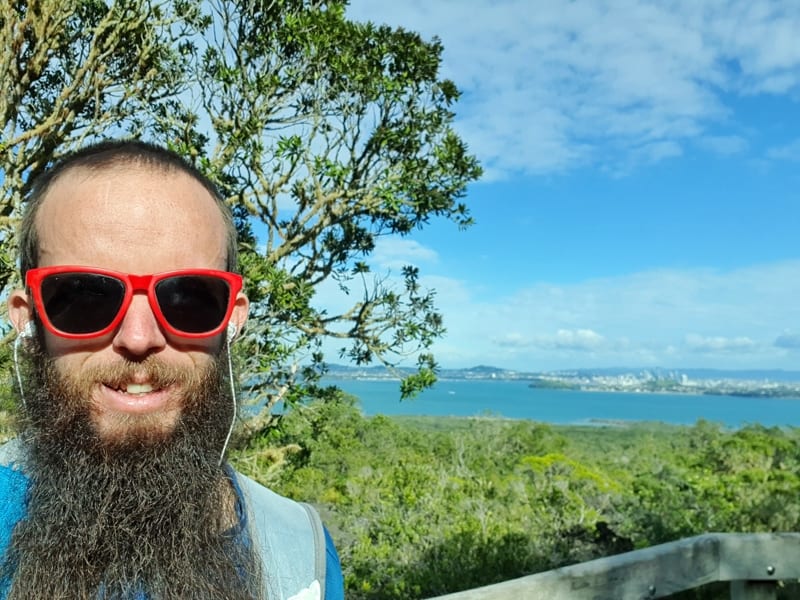
Proof I have visited Rangitoto Island.
TABLE OF CONTENTS
1. Rangitoto Island Walk Details
2. Rangitoto Island Summit Walk Map
3. How To Get There
4. My Rangitoto Hike Trip Report
1. DETAILS ABOUT THE RANGITOTO SUMMIT WALK
The Rangitoto Island summit walk is great. Once you arrive on the island, you’re next to the trailhead. It’s a straight-up the guts kind of track. Once you get close to the top there are some short (optional) detours before you hit the summit views.
The views are insane. And there’s plenty more things to do on Rangitoto, making it an awesome day trip from Auckland.
How long is the trip to Rangitoto Summit walk?
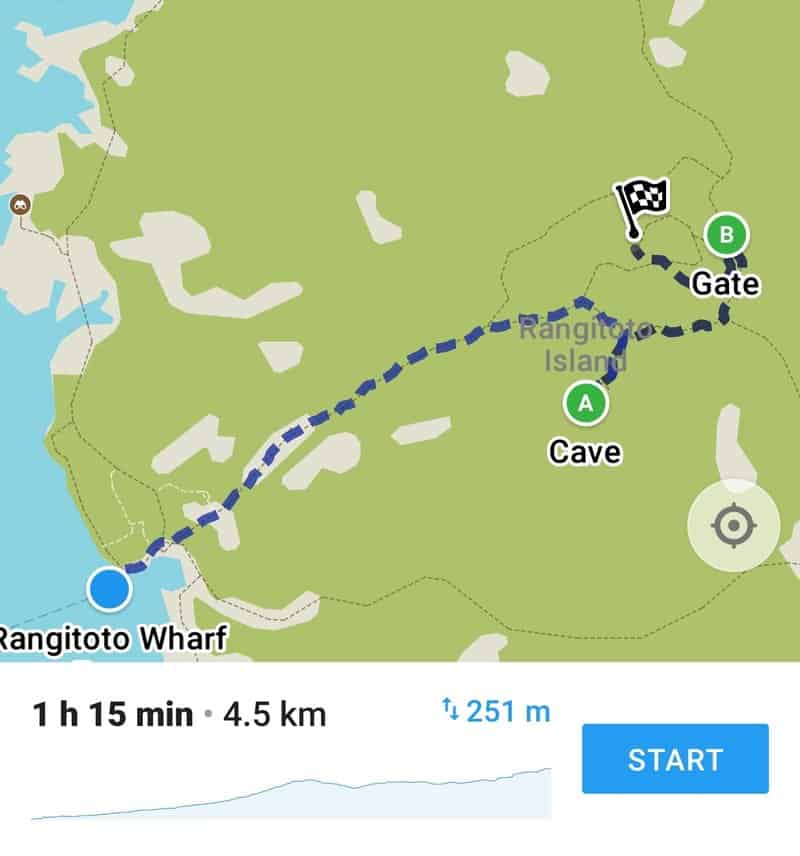
To reach the summit via the Lava Caves was a 4.7km walk meaning it’s under 10km return which is shorter if you exclude the caves (don’t).
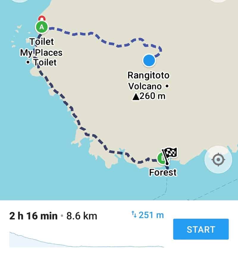
In the map I show below for the loop via McKenzie Bay Beach, the total distance was 13.25km (see Strava details here).
How hard is the Rangitoto Island hike?
Easy-medium.
What’s the elevation gain for the Rangitoto Island walk?
The Rangitoto summit is 259 meres above sea level. My Strava details had the total elevation gained at 323 metres. It’s a reasonably steady ascent with a couple of short descents on the way up (because of the lava caves detour). So it’s definitely not more than 323 metres I feel.
Here’s the elevation profile for the route I took:

How long will it take me?
I was hiking at a pretty solid pace, stop for photos but not reading the information signs. I then walked via the Lava Caves which are cool. With that said it took 70 minutes to reach the summit.
If you’ve got kids, 70 minutes will be on the faster-end time-wise but there’s going to be so much variance with the lava caves, and how much you are fascinated by the lava rocks.
The full 13.25km loop took me just over 3 hours. This was at a descent pace, especially for the last 5km, with no time relaxing at the beach. You can do the loop in this time easily. If you catch the 9.15 am ferry, you’ve got at least 4 hours and 30 minutes to get the first ferry back to Auckland, so there’s plenty of time for everyone to complete the loop.
2. RANGITOTO ISLAND SUMMIT WALK MAP
Unfortunately not all the Rangitoto Island trails are on Google Maps, but there are plenty of signs at all the junctions so you won’t get lost. And the trails are well-formed.
The screenshots above, via maps.me, are:
1. the route that I took to the summit, which goes via the Lava Caves and takes the stairs to the top.
2. continuing on from the summit to McKenzie Bay Beach and following the coast back to the wharf.
3. HOW TO GET THERE
You’ve got two options to get to Rangitoto Island.
FERRY
The most popular way is to get a ferry from Pier 13 and 14 on the Auckland waterfront.
Two tips about the ferries:
- make sure you leave plenty of time to get to Pier 13 and 14, where the ferry departs.
- it’s cheaper to book your tickets to Rangitoto Island online. Adult tickets are $58 return, and $26. There’ll often be a deal for a family pass online too. You can book tickets on the website here.
p.s. You can sometimes get a good deal with Ferg’s Kayaks on BookMe.co.nz here.
There are limited ferries so double check the timetable, ideally get the first ferry in the morning. You can view the latest timetable here.
KAYAK
For the adventurous, you can rent a kayak to get out there (or take a guided tour). I did a quick search and found two companies who can help arrange that, Fergs and Auckland Sea Kayaks (I haven’t used either one so can’t provide any personal experiences).
4. MY RANGITOTO ISLAND EXPERIENCE
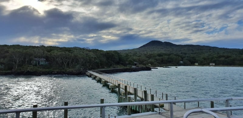
I picked a pretty nice day to visit Rangitoto Island, and was one of ~15 catching the 10.30 am ferry. The ride over was uneventful, I sat inside rather than on the top deck, and we arrived at 10.55 am.
Walking off the wharf everyone seemed to have a pretty good idea on what they were doing for the day. There’s not much in the way of information boards and maps at the wharf, but there are signs letting you know where each track is heading too.
To get to the summit track you continue straight after getting off the wharf and take a left after a couple of hundred metres when you hit the summit track sign. Most people were heading this way.
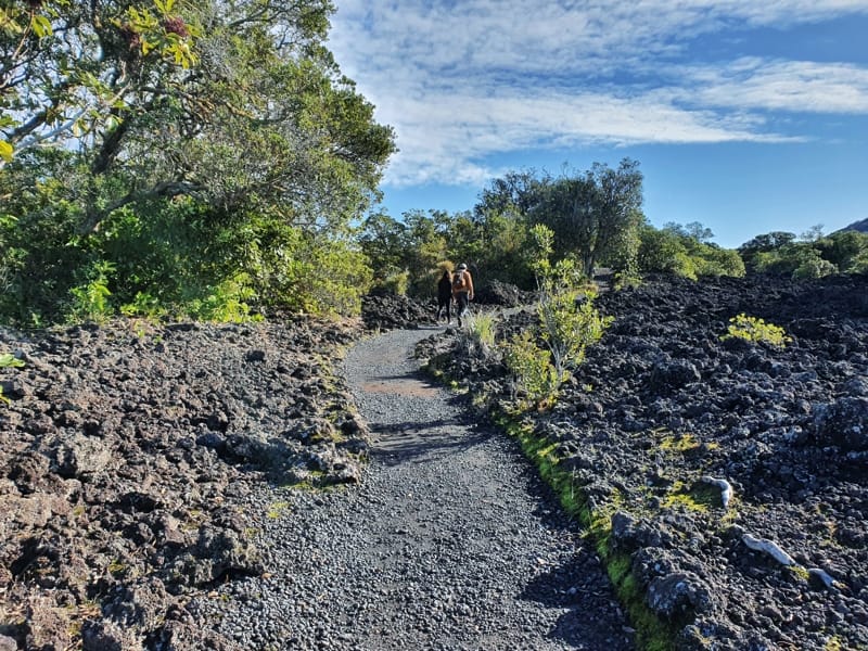
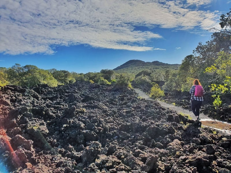
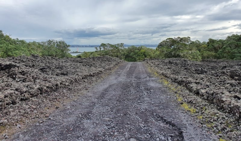
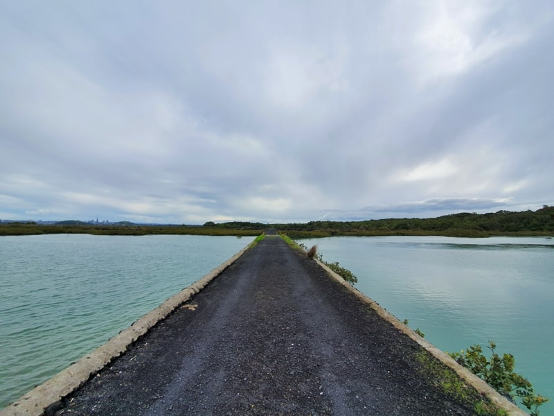
As soon as you turn left the incline begins and you’ll soon start to realise you’re on a volcano with the black volcanic rock on either side of the tracks creating a pretty surreal environment. It’s certainly different from other walks in Auckland.
The incline isn’t crazy to start, and along the way you’ll see a couple of small turnoffs to take advantage of viewpoints and/or see information about the area. They’re worth a quick read to help you gain more context about what you’re exactly experiencing.
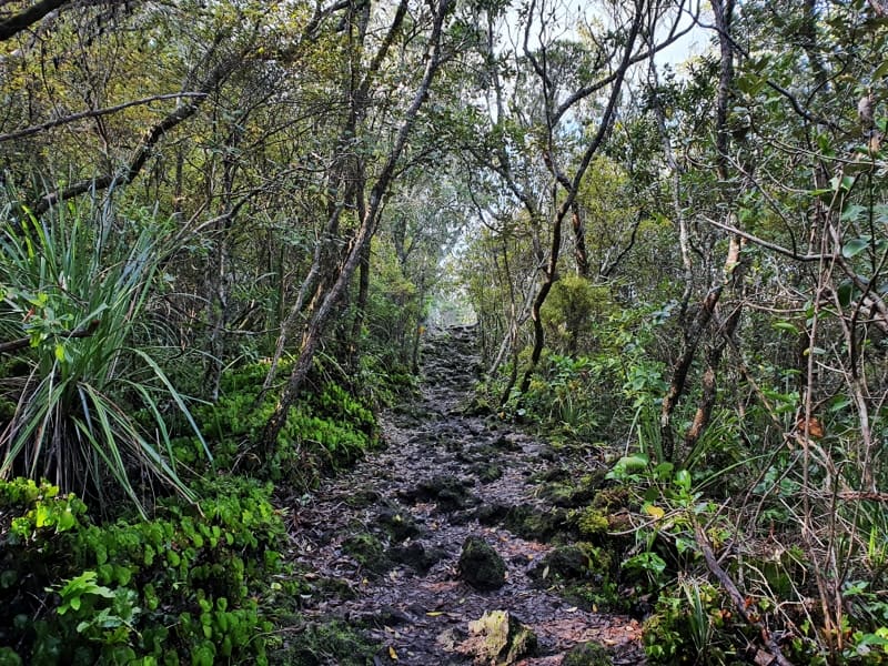
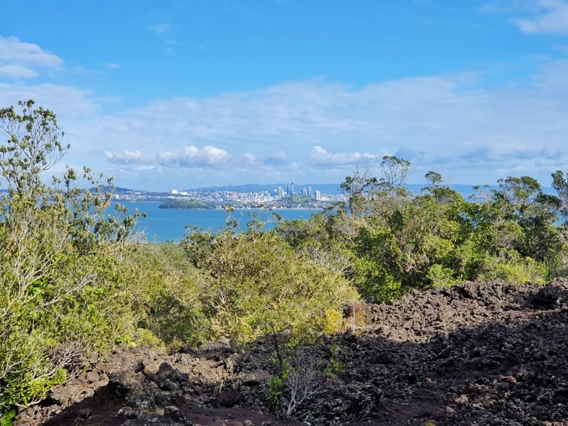
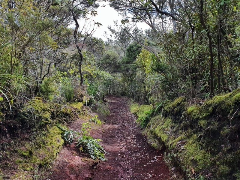
When you look at Rangitoto from the mainland, you won’t be surprised that the walk gets steeper the further in but it’s never crazy steep. On a warm day you’ll get a sweat on. What I did find confusing was the volcanic rock starts to disappear from the edge of the tracks higher up the volcano and you’ll start seeing more ‘normal hiking terrain’ with tree-lined tracks. It’s pretty all the same.
Anyway, the loop I mentioned above takes us to the Lava Caves first. To get to them you just need to stay right whenever there’s a junction, but again the signs are super easy to follow. The final section of the walk to the Lava Caves sees the well-manicured track get more technical which will slow your pace for a couple of hundred metres.
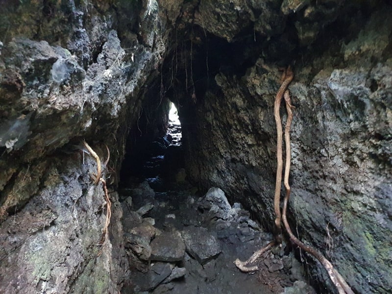
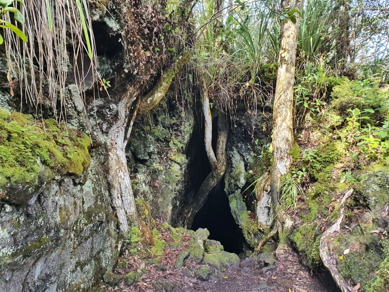
The distance from the wharf to the lava caves is about 2.7km and they’re well worth the detour. You’ll see the cave on your left-hand side. Get your torch up and enter if you dare. It’s a nice little rush when you’re inside and most people should be okay with getting through them without freaking out.
p.s. mind your head.
After the caves you’ll need to backtrack to the last turn off and turn right to continue on towards the summit. There are various routes to the summit but I like the idea of coming from the north side of the summit via the stairs so you get some bonus views on the way up (when you’re on the stairs).
In this section I started to hear some bird calls, and saw a couple of Saddlebacks which reminded me of my visit to Kapiti Island and a parakeet.

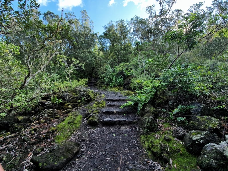
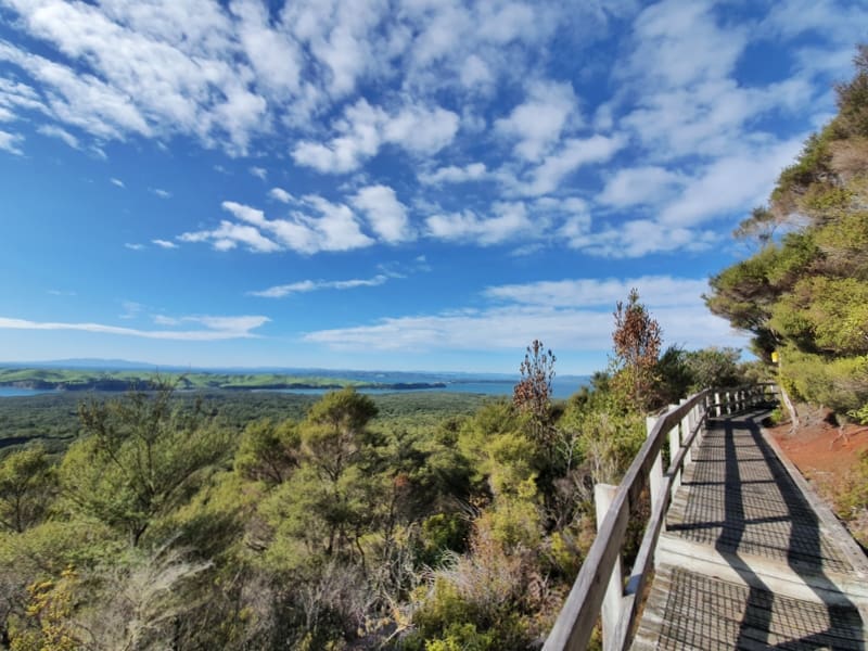
Once you hit the stairs, you’re not far from the summit. While there’s a lot of stairs, they’re not steep so it’s still a comfortable walk. Before you know it you’ll be at the edge of the crater which you can look down into. Full of lush greenery it’s not as dramatic as the crater on Mount Eden which you see on the Auckland Coast to Coast walkway.
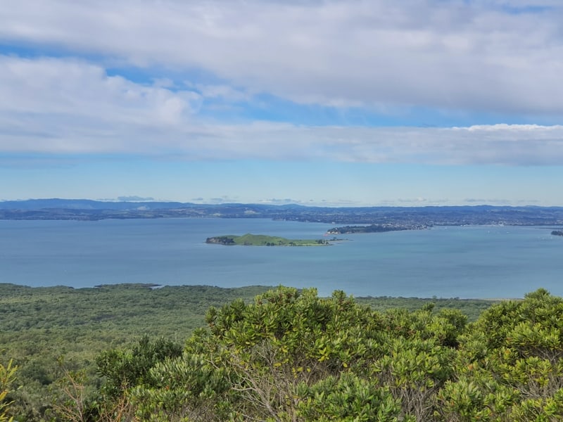
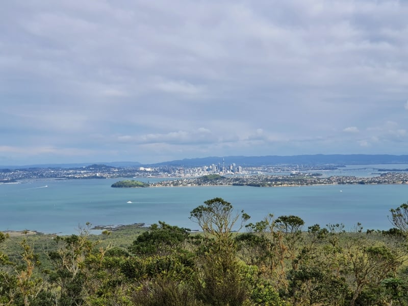
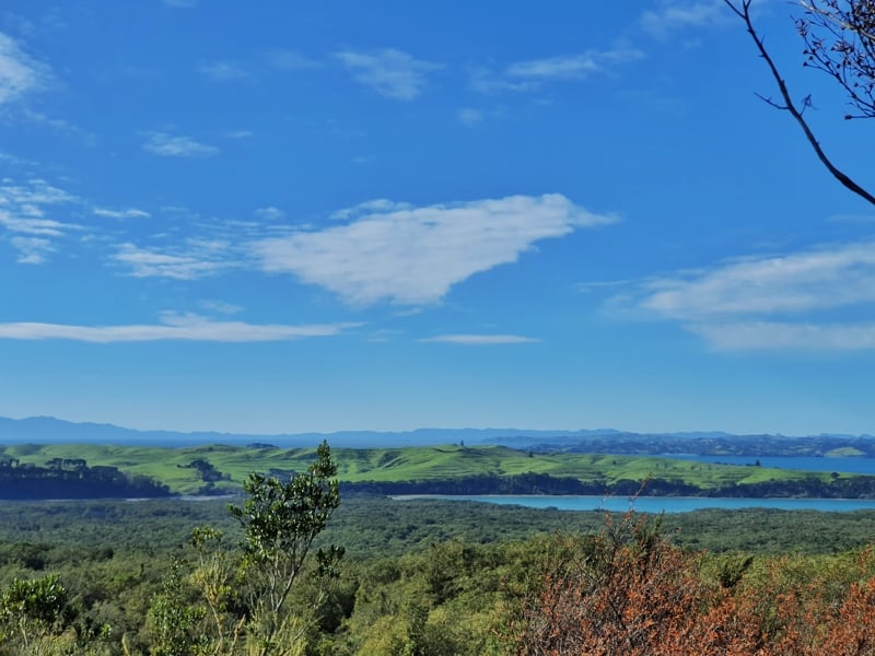
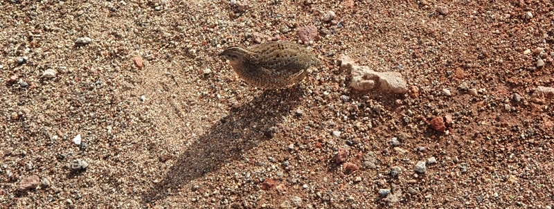
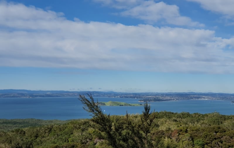
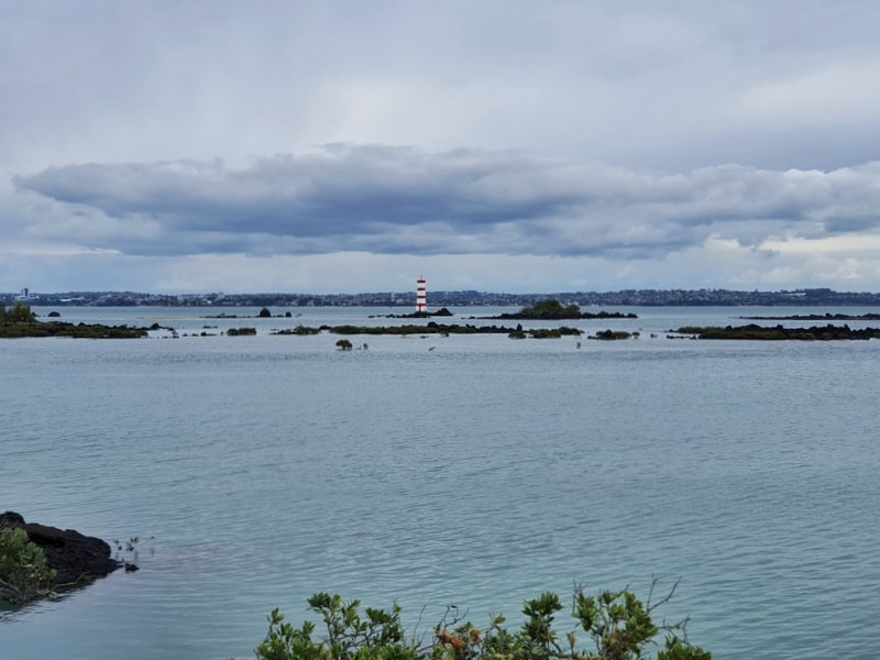
This isn’t the summit though, You’ll need to walk another couple of hundred metres along the crater rim track to reach the summit and it’s well worth it. This is where you get epic views in all directions. The views of the city are my favourite. I loved it, and there were some baby brown quails hanging around out here too. So cute.
If you’re bringing a picnic (there’s no food for sale on the island) this is your picnic spot.
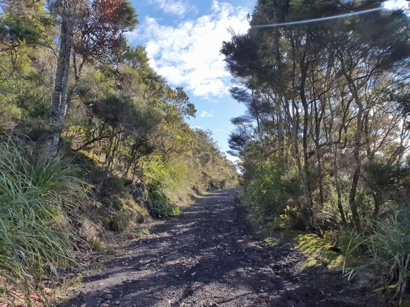
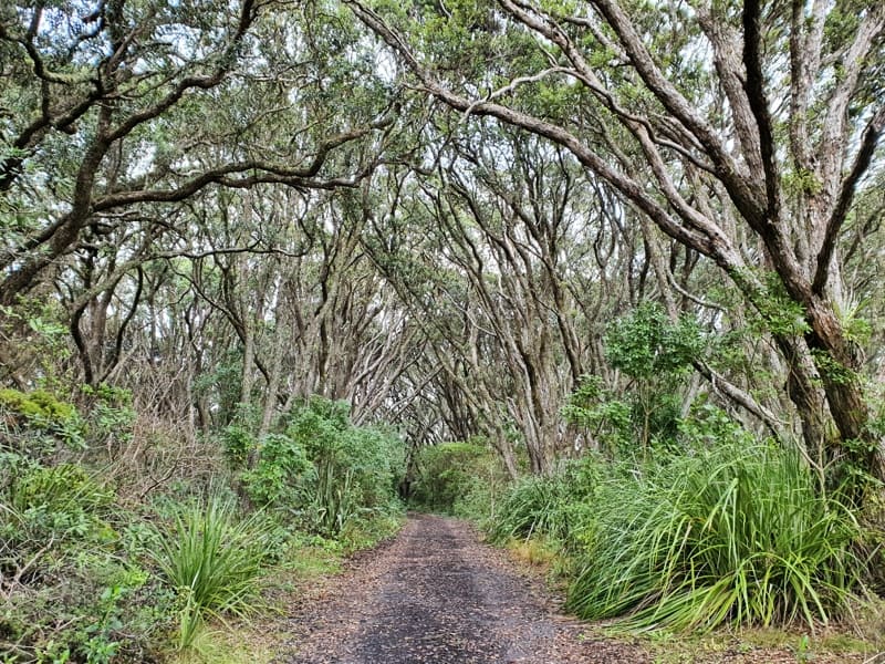
Now, you could go back down to the wharf, but as long as you’ve got a half-decent walking pace it’s time to head west on McKenzie Bay Road (photo two in the maps above). This stretch is a super steady descent on nice terrain. And it was quite nice to drop back into that volcanic rock terrain again.
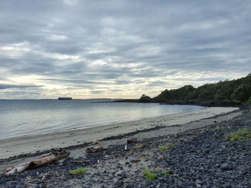
McKenzie Bay Beach is very picturesque, and on a warm summer day, I’d imagine it’s super nice for a swim. Again, it’s a good place for a picnic.
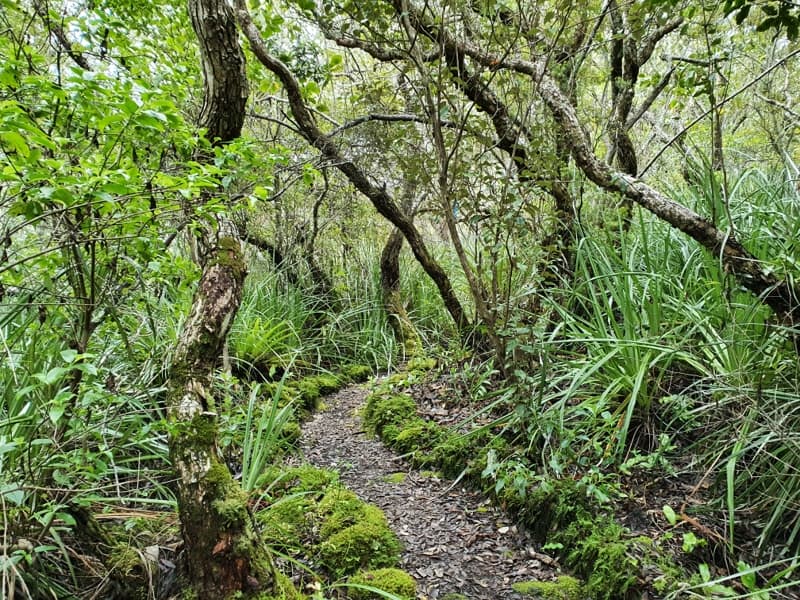
After the beach, it’s just over 5km following the track along the coastline back to the wharf. It’s a nice walk with some good views, but by this time I was ready to get back. When you get close to the wharf there are a few different routes you can take, I enjoyed the kowhai track. When the kowhai trees, it’d be more stunning again.
And after all that I got back to the wharf at about 2 pm. If you’re taking your time, you’ll be catching the 3.30 pm ferry in most cases as I didn’t stop to eat, or have a swim. If you need to catch the 2.30 pm ferry it’s comfortable to make it via this loop, and another group who had done the same loop were back in time for it too.
I’d been meaning to make a trip to Rangitoto Island for years. I’m stoked I finally did it. The ferry ride at $39 for an adult is quite expensive, but once you’re there you’ve got no more costs (e.g. no overpriced cafes) so you save money on that end of the journey. So overall, I’d say Rangitoto Island is worth visiting.
If you make the trip, please let me know if you followed the route above and what you thought of it in the comments below or email jub@churnewzealand.com.
p.s. Here’s a map of all the hikes documented on Chur New Zealand. You can click the icon to see brief details, as well as a link to read more about the hike (like this post).

Hey, it’s Jub here. I’m the guy behind Chur New Zealand, helping you have the best time hiking, trekking, walking…whatever you want to call it…in NZ. I’m based in Queenstown and am always out and about exploring trails, old & new. If you have any questions, reach out.