The Basin View Track is a sneaky good track! It was a track to fill in some time on the wa to St Bathans for the evening,but we were super glad to find it. I would do it again.
Located a 5 minute drive from the heart of Alexandra in the Flat Top Hill Conservation Area, this post will give you all the details you need to know for completing the loop.
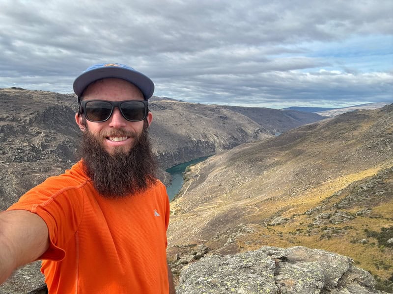
TABLE OF CONTENTS
1. Basin View Track Details
2. Basin View Track Map
3. How To Get There
4. My Basin View Track Experience
1. DETAILS ABOUT THE BASIN VIEW TRACK
- QUICK DETAILS:
- Distance: 7.5 – 8km
- Elevation Gain: ~330 metres
- For Who: Those with a few hours to spare in the Alexandra area
- Download GPX File
How hard is the Basin View Track?
DOC has it as an advanced tramping track, but I’d put it more in the moderate category. While it’s a rocky trail, there’s very few parts which I would consider technical. And the uphill is mostly in a short section, where it’s steep and not unruly.
What distance is the Basin View Track?
DOC measures the route at 7.5km, but I got just under 8km for the route (returning to the carpark). Plan for 8km.
What is the elevation gain of the Basin View Track?
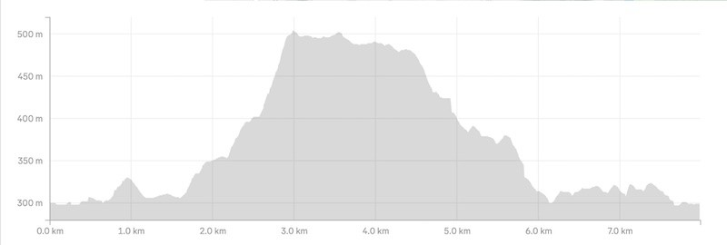
Based on my data, it’s about 330 metres of total elevation with about two thirds of that in the one climb that starts about 1.6km into the trail
Here’s the elevation profile:
How long does it take to do the Basin View Track?
I try not to give a timeline for most hikers now…but I’d suggest it’ll be 2-3 hours for most. There’s plenty of rocks along the top for a picnic with a view.
What’s the best direction?
The way we went, anti-clockwise…so you can go up the steeper section.
2. BASIN VIEW TRACK MAP
The map below is the GPX file from my route embedded on topomap.co.nz. Clicking the image below will open it in a new window.
While you don’t need a GPX file, there’s some spots where you could take a wrong turn so there’s no harm in downloading the GPX file. I personally think TopoNZ50 is the best topo map app.
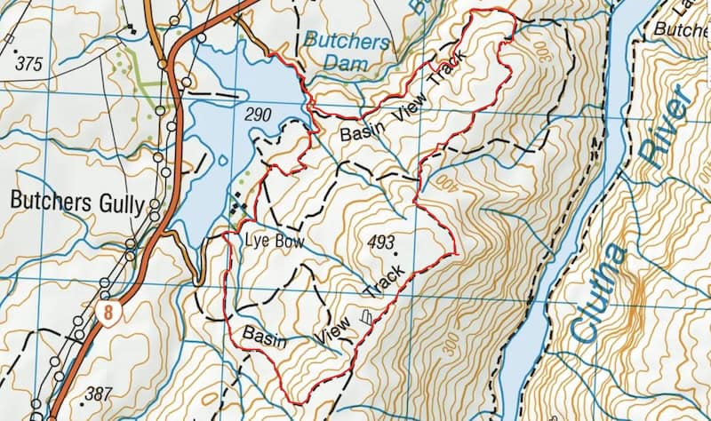
The route is marked, but it could be improved slightly. We took one wrong turn…which may have added on a few metres of the track, but returned to the correct track soon enough. There’s quite a few MTB trails around so just be sure you’re looking out for the orange markers. Alternatively, grab the GPX file linked above.
3. HOW TO GET THERE
The Basin View Track carpark is here on Google Maps (plenty of space for lots of cars).
It is 6km or 5 minutes from the centre of Alexandra to the carpark. The road to the carpark isn’t on Google Maps (you can see it on satelitte view), but it is well signposted in real life.
The easiest way to get there is by car. You could possibly taxi or hitchhike from Alexandra, but car is easiest. Or if you’ve got a bike while in Alex, it’s a short enough bike ride if you’re confident riding on roads with cars going at 100km/hour.
4. MY BASIN VIEW TRACK EXPERIENCE
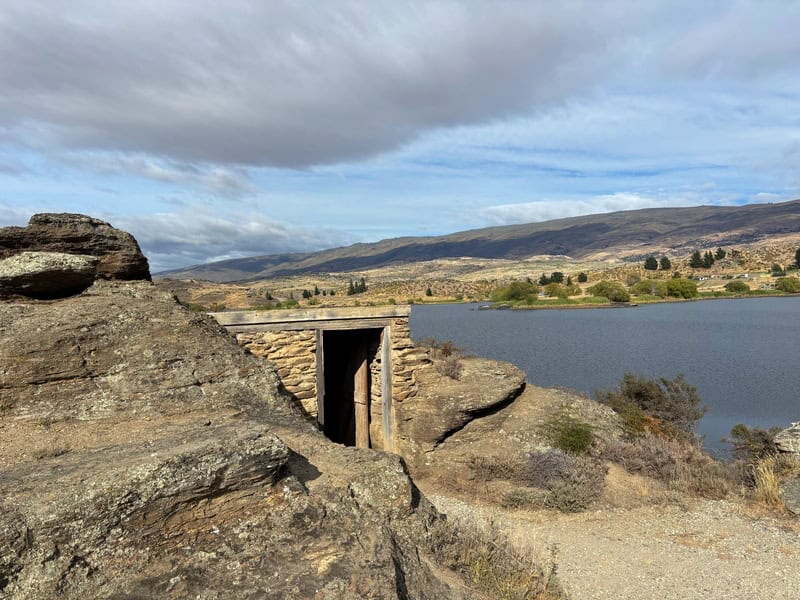
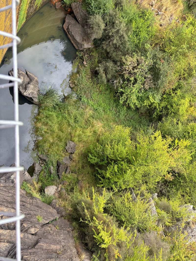
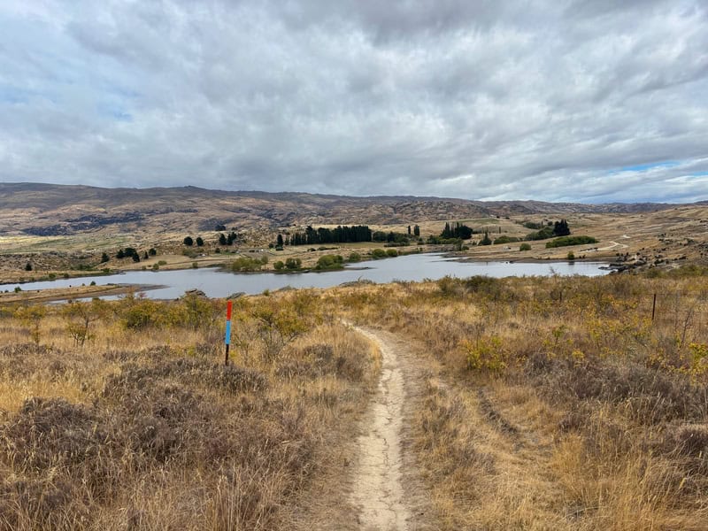
The start of the loop is solid, with myself saying ‘oh, that’s cool’ several times. You start by passing next to the dam, pass the schist house (there’s some information boards about the history through the walk) and make your way over the walkway crossing the dam. This was fun!
I saw Butcher’s Dam on the map…just didn’t click that it was an actual dam.
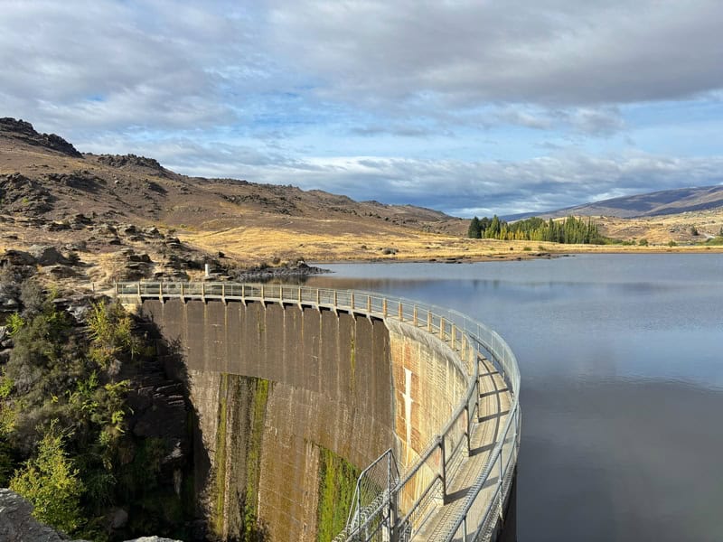
Crossing the dam, and you’re now on the track…make sure to follow the right hand route and you’ll come across the toilet on your left in a couple of hundred metres.
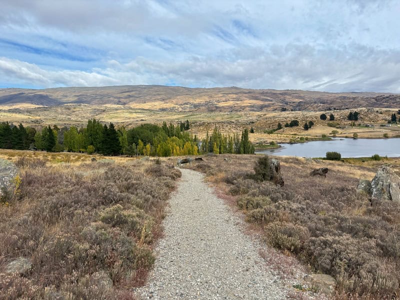
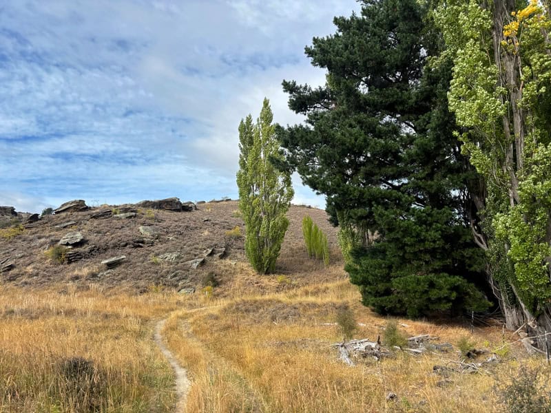
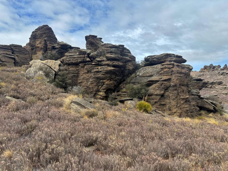
The trail has several green DOC signs, take the time to see where they’re pointing you as there is lots of tracks. Following the trail, you’ll quickly be in the thyme lined trails as you go up and down the first descent (25 metres high)…you’ll get a glimpse of the dam below. Back on the flat, and you’ll walk towards some of the only actual trees you’ll see on the trail as per the photo below.
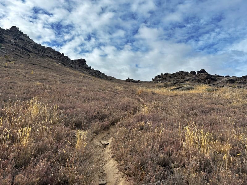
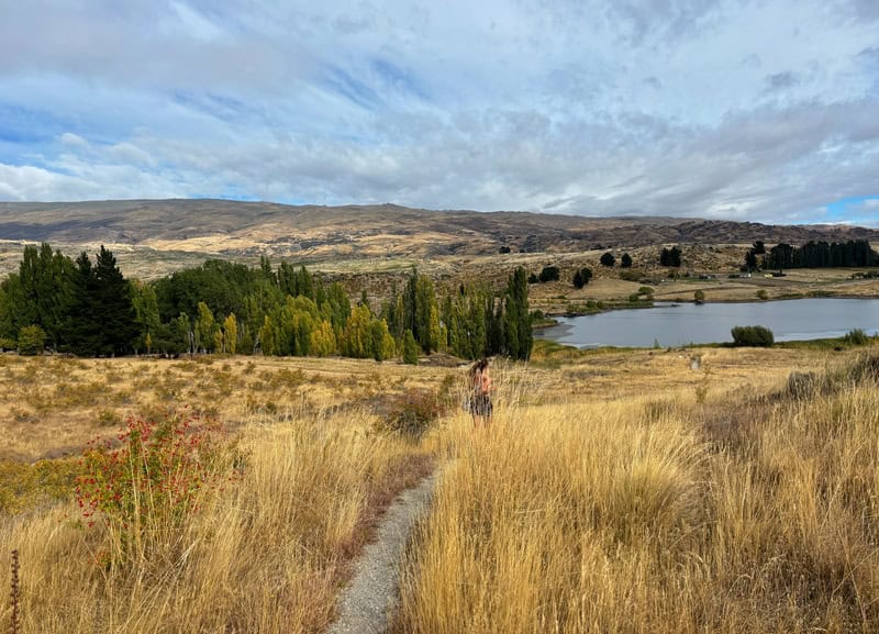
Then the climb up to the flat top begins. It’s a bit of a grueling climb with a single track squeezing in between the thyme plants. I enjoyed it, but on a warm summers day it’ll be scorching. You can see where you’re going more or less…whether that’s good or bad I’ll leave it up to you to decide. As you get close to the top, you veer left and it may break your heart with a little bit more climbing left. But you’re basically there!
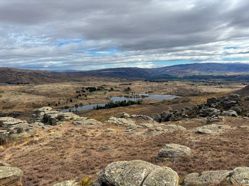
Then you get up onto the flats, where you’ll cruise along for a while. Make sure to find a comfy rock or three to enjoy the view first. With snacks.
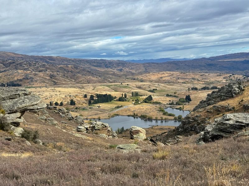
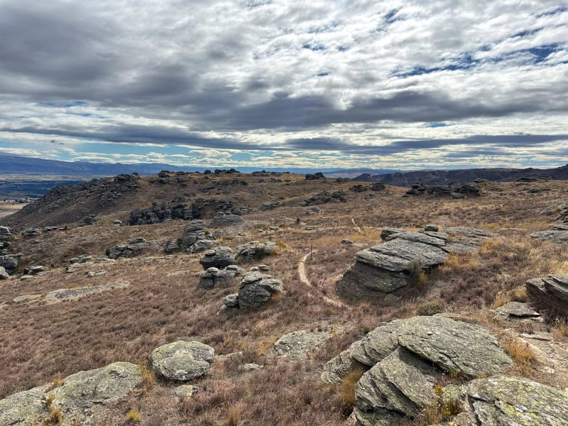
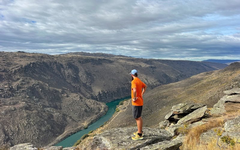
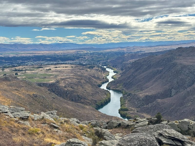
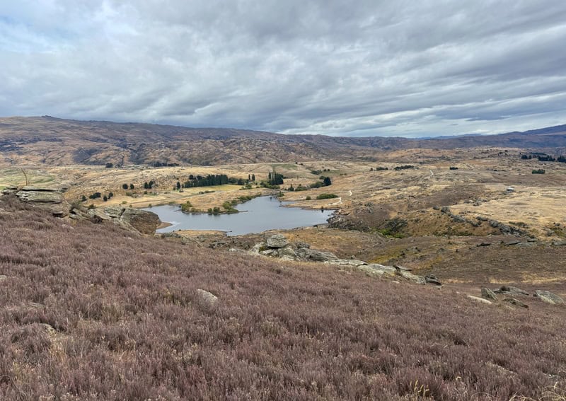
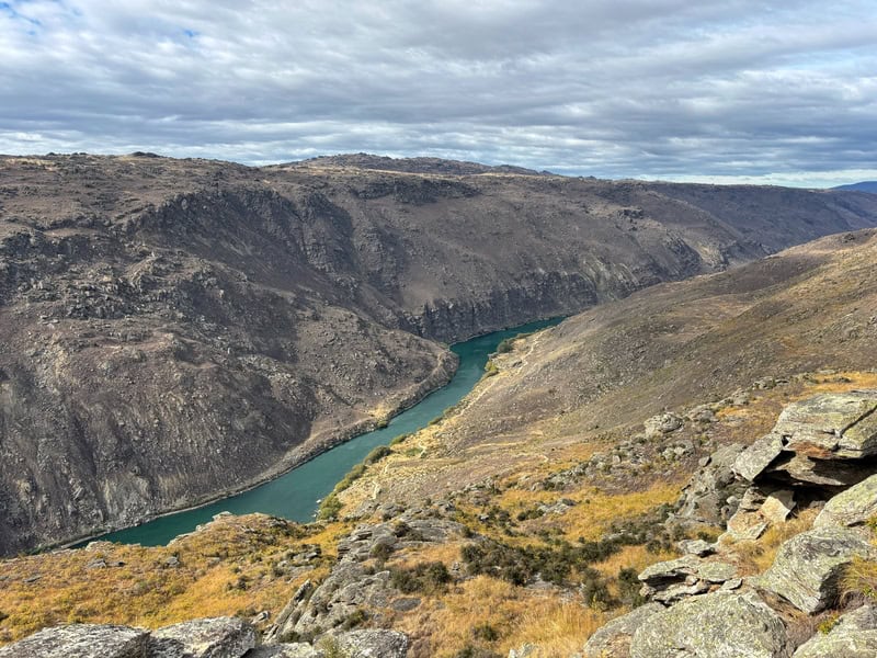
From here you’ve got about 1.5km along the tops, with varying views including views over Alexandra, the Clutha River and the gorge trails below.
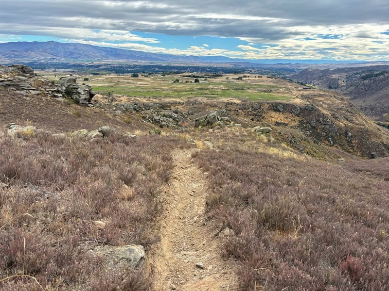
Then you’ve got the steady, consistent descent which does drop down 180 metres over 1.7km with a few little juts back up again. The descent does have some steep sections, with some awkward steeps every now and again. Oh, and make sure you’re following the orange poles…sometimes they’re far apart so you may want to double check the GPX/topo from time to time.
The trail did seem to take forever at points on the way down…like it felt like we were never going to end up back at the carpark. But when it flattens out, it becomes an undualting trail on the way back to the carpark.
This last section is a little under 2km long, but the undulations will keep you honest so it’s not like you’ll hoon through this section. And then you link back up just before the dam for another walk over that to the carpark.
Great loop!
I had zero expectations of the Basin View Track, and I was very surprised but stoked to discover this trail. It’s a real asset to Alexandra. It’s not one I would necessarily go out of my way to hike, but if you’ve got time in the area…the Flat Top Hill Conservation Area goes good!
Got any questions or comments about the Basin View Track?
Leave a message below or email jub@churnewzealand.com.
Chur.
p.s. Here’s a map of all the hikes documented on Chur New Zealand. You can click the icon to see brief details, as well as a link to read more about the hike (like this post).

Hey, it’s Jub here. I’m the guy behind Chur New Zealand, helping you have the best time hiking, trekking, walking…whatever you want to call it…in NZ. I’m based in Queenstown and am always out and about exploring trails, old & new. If you have any questions, reach out.