Bullendale Hut, deep in Skippers Canyon is a place everyone seems to say they want to visit for the beauty and historic value.
But most don’t given the main access to Mount Aurum Recreation Reserve is hard. That’s a good thing for you however, as Bullendale Hut is a fun day or overnight hike (pending your feelings about river crossings), with a good chance you’ll have the hut to yourself.
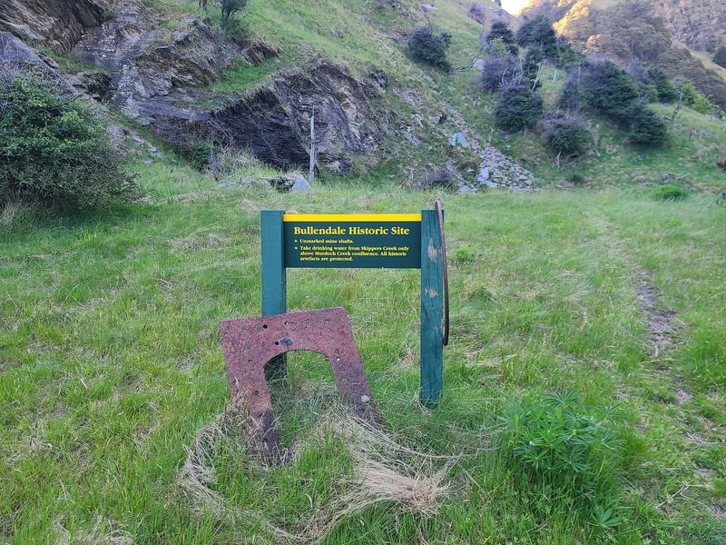
It’s worth it, to stay in a hut that is at the site where in 1886 it became the first time, hydro-electric power was used for industrial purposes (gold mining). A quick search about Bullendale Hut history will dig up some articles (this one is good) that may be of interest, and details about why Bullendale is listed as a historic place.

At the bottom of section 4, I have a GPX file you can download to link up Bullendale and Dynamo Huts over point 1475 on the topo map.
TABLE OF CONTENTS
1. Details About The Bullendale Hut Hike
2. Bullendale Hut Map
3. How To Get There
4. My Bullendale Hut Experience
1. DETAILS ABOUT THE BULLENDALE HUT HIKE

QUICK DETAILS:
- Distance: ~20km return
- Elevation Gain: ~885 metres
- Track type: Out and back
- Time: Long day or overnight hike
- Difficulty: Medium
What are the Bullendale Hut fees?
As a standard hut the fees are (as of Nov 2025):
- Adult (18+ years): $10 per night
- Youth (5–17 years): $5 per night
- Child/Infant (0–4 years): free
Make sure to buy your
How hard is the Bullendale Hut hike?
Under good conditions, the hike is at a medium level of difficulty. There’s certainly some elevation, but for the most part the track is in good condition. It’s the number of river crossings that make it hard if anything. There’s so many! But as long as there’s been no rainfall recently, they’re not high (knee deep – I am 172cm tall) for the most part.
It is remote and rugged terrain though, which is a reason some equipment is left up in the valleys. It was simply to hard to remove much of it when the mines shut down in the early 1900’s.
Some buildings were demolished for the iron, but the remote and rugged situation prevented the removal of much of the heavy equipment. As a result, the remains of Bullendale are remarkably intact.
What distance is the track to Bullendale Hut?
Based on my Strava file the distance from the carpark mentioned below to the Hut is somewhere ~9.5km. That’s not including going to check out the historic battery near the hut. Plan a for a 20km return hike, or more if you want to explore Caspers Flat beyond the hut.
What is the elevation profile of the Bullendale Hut track?
From the carpark to Bullendale Hut is 525 metres of elevation gain and 360 metres of descent. That makes for a total elevation gain of 885 metres for the return hike.
Here’s the elevation profile from the carpark to the hut:

How long does it take to hike to Bullendale Hut?
Given the distance and elevation change, it takes longer than you think to get here. DOC recommends 4 to 6 hours return, and honestly, that seems about right. If you can get there and back in 4 hours, you’re doing really well.
The river crossing slow things down!
If you’re on the slower end, I’d allocate about 4 hours each way. It’s longer than you think…and while DOC recommendations are usually something I get under comfortable, I’m pretty sure it was over 4 hours and closer to 5 for me to return.
2. BULLENDALE HUT MAP

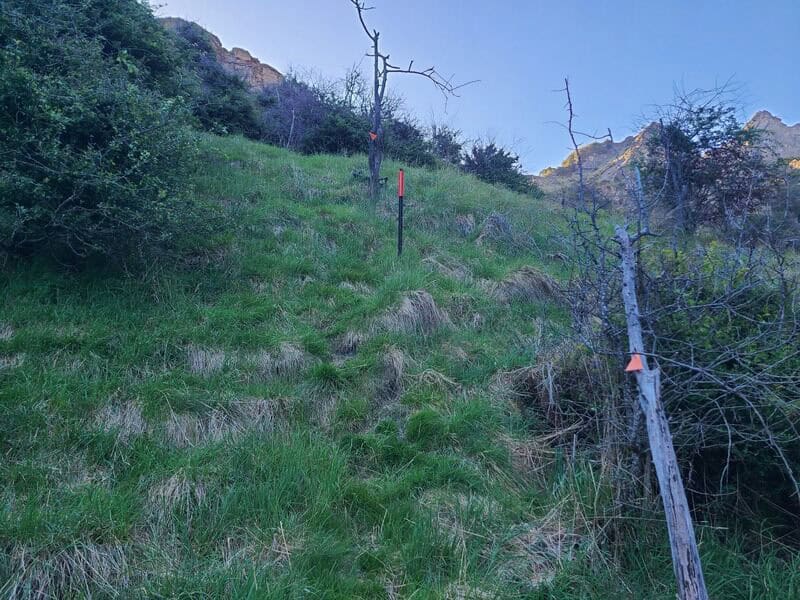
The map above is the GPX file overlaid on a topo map. On the topo, there’s one section where the track is unmarked when you’re following the river. But it’s easy enough to avoid as long as you keep an eye out for triangles. As I mention below in the hut experience, there’s a couple of turn offs you could potentially miss.
3. HOW TO GET THERE
This is the tricky part, and the reason why more people aren’t doing this hike. Skippers Road has a reputation as being the most dangerous road in the world. As someone who doesn’t drive, I can’t speak to how real/unreal this claim is, but it’s not an impossible drive.
Companies drive passenger buses up and down the road multiple times a day. You’ll need a 4WD and a confident driver ho. The drive to the carpark (here) takes about an hour from Queenstown. Be sure to check the road is open before you head down.
Personally, I’ve been lucky hitchhiking up and down the road on the two occasions I’ve been down there (with some walking sections). There’s not a lot of traffic, so be prepared for a looooong walk in/out potentially.
Rentail Note Car. If you’re planning to rent a car, most of the time, any insurance will be void if you drive on down to Skippers Canyon.
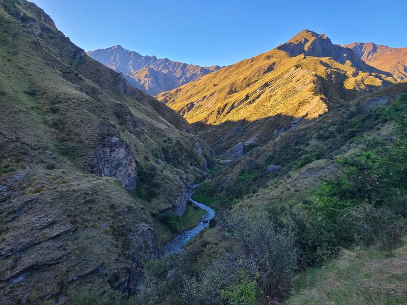
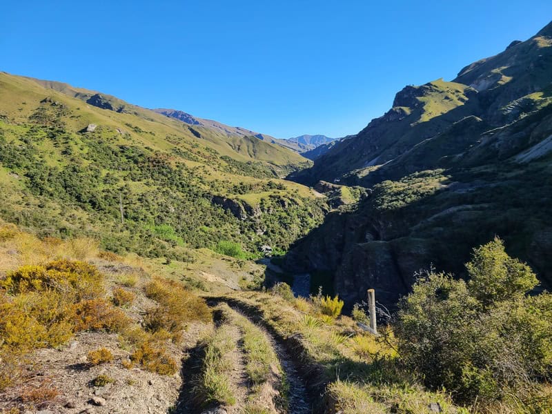
4. MY BULLENDALE HUT EXPERIENCE


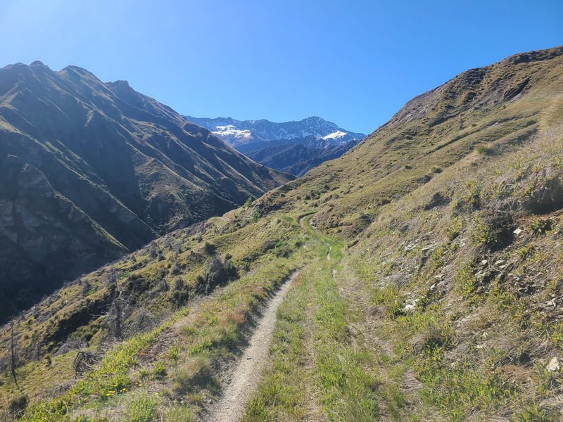
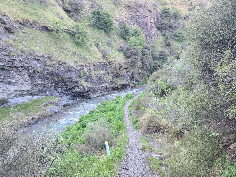
Starting from the carparking area (here), you’ve hike on a 4WD road to start. You get some nice views right away before dipping around a wee stream, which you’ll keep your feet dry on. And you’ll see the ruins of the old Otago Hotel.
Take in this relatively easy section of hiking as once you get to the first proper stream crossing, you’ll slow down as you proceed to cross the river rather often throughout the hike. The first time I did this hike, my friend took her shoes off…only to find out that was pointless. Unless you want to take them on and off all day…

Once you hit the second river crossing, make sure you take the sneaky right hand diversion rather than aiming for the 4WD straight ahead, that’s not the right direction. You’ve got a bit of a climb, now before you eventually drop back down into the river.
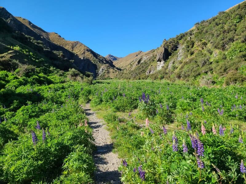
The last time I went was at the end of November, the lupins were out which made for a beautiful (invasive) path between the rivers.

When crossing the rivers, you’re usually aiming for the spot directly on the opposite side. It should be quite obvious where you need to go…and if you get confused, make sure you’ve got a good topo map app handy, or paper maps.
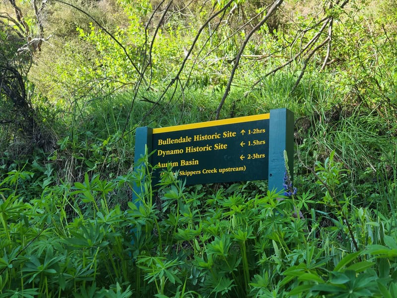
You’ll eventually get to the junction, where there’s a sign that’s somewhat hidden by shrubs…you’ll want to go to the right up on the Bullendale Track (otherwise you’ll head on the Dynamo Track/Hut).
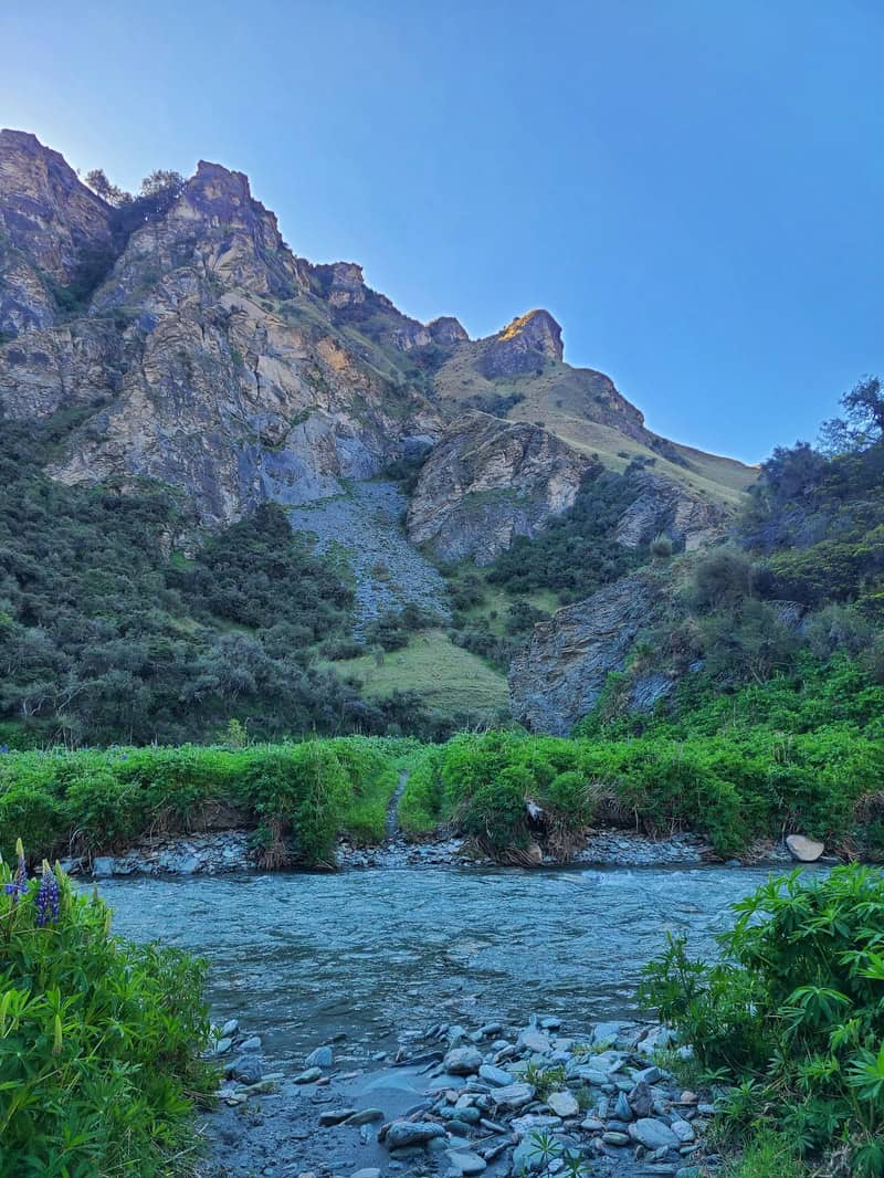
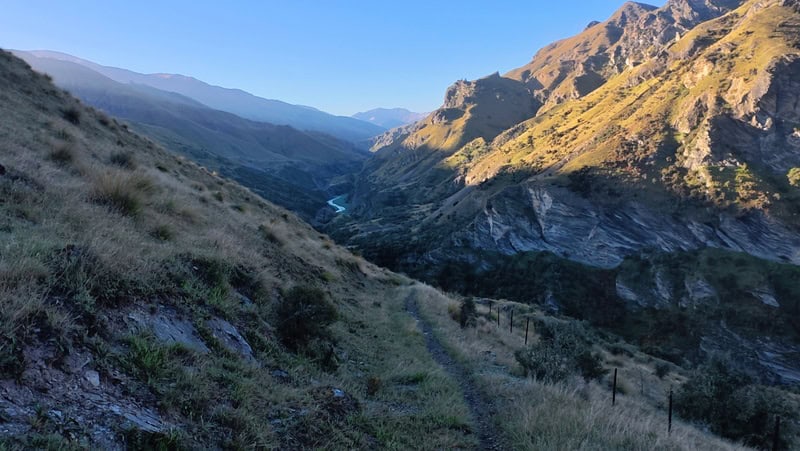
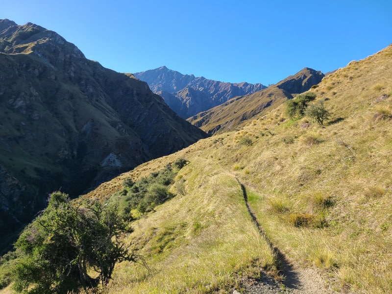
You’re on the land here again, as you pop up and over on a two hills to rejoin the river in two kilometres. This is a beautiful section, I had nice lighting at the end of the day which helped.
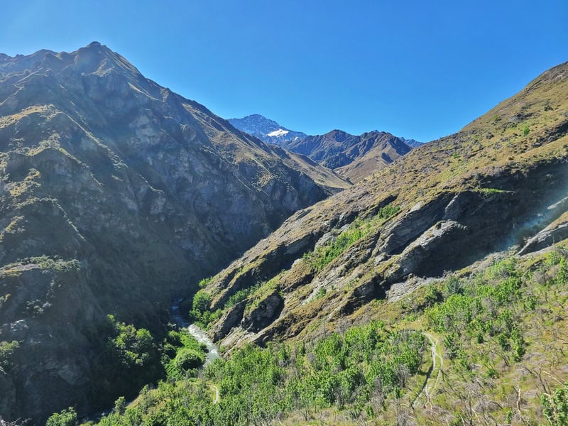
Back into the river and this section is cool with the cliff rising steeply on your left (true right). Both times I’ve been up here, there’s been goats climbing away from me…impressive on the cliff faces!
Once you’re in the river here, it’s not long to go (1.3km)to the hut …you’ll pop up on the left hand side, of the river eventually and start to see some artifacts lying about (like the old cans below).

Then the final push to the hut! It’s sneaky steep, possibly the hardest part of the hike as it can be slippery. But it’s short so you’ll survive.
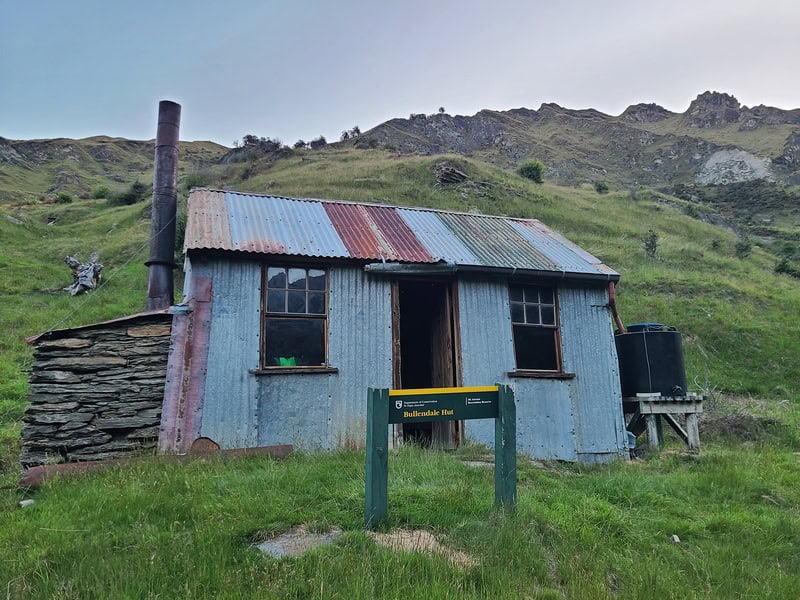
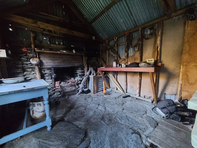
Then you’ve made it to Bullendale Hut, woohoo. There’s some great space out the front of the hut for a well deserved fest (if you have your mozzie spray). Named after George Francis Bullen (1832 – 1912), it’s hard for me to comprehend how hard the miners of the time worked.
While at the hunt, you can continue on past the hut exploring around Caspers Flat, or there’s the disused battery spot marked on the map to see as well.
The Return Journey
The next day, you’ll just want to head back the way you came. It’s easier on the way back given you know how the track works.
The Alternative Way Back
If you’re after a longer trip for a couple of nights, you could go the creative way to Dynamo Hut (rather than going back to the junction and heading down to Dynamo).
You could continue down past Caspers Flat past the Skippers Creek Right Branch, then head up to point 1475 on the topo map before dropping back down the otherside to Aurum Creek/Basin. Here’s the GPX file you can download for that route as I did it…we spent a bit of time wandering, trying to find the line that looked best to get up to point 1475, but it’ll give you an idea of where to go.
This would be considered an advanced route, but people do, do it.
If you’ve got any questions or comments about exploring Skipper’s Canyons Bullendale Hut, let me know in the comments below or email jub@churnewzealand.com.
Chur.
p.s. Here’s a map of all the hikes documented on Chur New Zealand. You can click the icon to see brief details, as well as a link to read more about the hike (like this post).
p.p.s. Here’s a few more photos from the hike to Bullendale Hut.

Hey, it’s Jub here. I’m the guy behind Chur New Zealand, helping you have the best time hiking, trekking, walking…whatever you want to call it…in NZ. I’m based in Queenstown and am always out and about exploring trails, old & new. If you have any questions, reach out.