If you’re looking for a track that’s off the beaten path for most, unless you’re walking the Te Araroa Trail, then the 11 to 12km Kiwi Burn Hut Track is for you (or you can do a shorter out and back).
The Snowden Forest Conservation Area is surrounded by amazing terrain, but has top quality hiking trails in its own right.
Read on to find out all you need to know about day hiking and/or overnighting the Kiwi Burn Hut Track (we suffered lots of treefall).
TABLE OF CONTENTS
1. Details About The Kiwi Burn Hut Loop Track
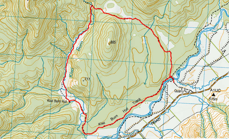
2. Kiwi Burn Hut Loop Track Map
3. How To Get There
4. My Kiwi Burn Hut Loop Experience
1. DETAILS ABOUT THE KIWI BURN HUT LOOP TRACK
- QUICK DETAILS:
- 11 – 12km
- 250 metres elevation gain
- Easy to medium (unless there’s treefall)
- 3 to 4 hours.
- Download the GPX File
How hard is the Kiwi Burn Hut Loop Track?
If there’s no treefall, the trail isn’t too difficult at all. Even the ‘advanced’ route. The track is quite obvious to follow. BUT if there’s treefall, the track becomes really hard to follow and the trees can be huge, in which case both sections of the track become advanced routes.
What distance is the Kiwi Burn Hut Loop Track?
The DOC website states 12km, but I feel like it’s a little less than that.
To Kiwi Burn Hut via the advanced route it’s about 6.6km and short route 4.6km (based on my Strava data).
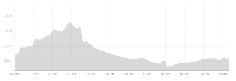
What is the elevation gain of the Kiwi Burn Hut Track?
Based on my Strava profile there’s 250 metres of elevation gain. Given our troubles though, there’s going to be a little bit less.
Here’s the elevation profile:
How long does it take to hike the Kiwi Burn Track?
According to DOC the full loop is 3.5 hours. 1.5 hours from the trailhead to the hut via the ‘family friendly’ trails, and 2 hours via the advanced route. We took a little under two hours for the advanced route, and 1 hour 50 mintues on the family friendly section…but that was with a massive amount of treefall. If the track is cleared, you could cover the full loop in 3 hours.
Are dogs allowed on the Kiwi Burn Track?
No.
What are the Kiwi Burn Hut fees?
To stay at Kiwi Burn Hut:
- Adult (18+ years): $10/night
- Youth (5–17 years): $5/night
- Child/Infant (under 4 years): free
You can learn about DOC Hut Tickets here, and DOC Hut Pass here.
What’s the Kiwi Burn Hut like?
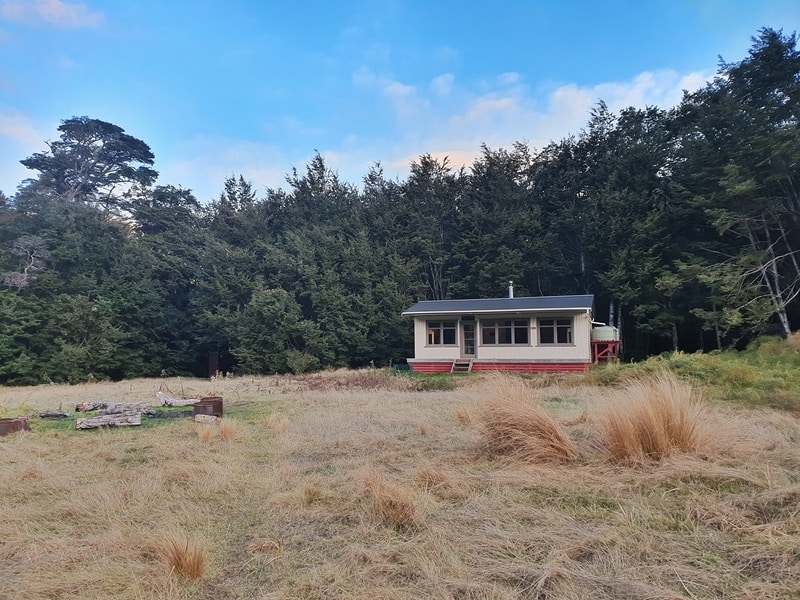
It’s a super cool hut, I got scout club vibes. It’s in a stunning position with a cool fireplace. And it’s nice that the bunks are separated into two rooms with doors off the main communal area.
2. KIWI BURN HUT LOOP TRACK MAP
*Clicking on the image below will open the map in a new topomap.co.nz window.
I recommend downloading this topomap app, as you can see the hut of Google Maps…but not the track. You can see the track on the Maps.me app though, another great app for hikers.
3. HOW TO GET THERE
The Kiwi Burn Hut Track is located on the gravel road to Mavora Lakes…there’s a big DOC sign, you can’t miss it. The gravel road starts shortly after you turn off State Highway 94.
The easiest way to get there is by car as there’s no public transport to get there. Alternatively, you could be adventurous and use it as a hike to break up the Around The Mountains cycle trail.
from Queenstown, you’ll take at least 2 hours to travel the 156km. From Te Anau, it’s about an hours drive.
If you’re camping at Mavora Lakes, it’s a short drive away or you can walk down the river from South Mavora Lake for about 12km to the trailhead.
4. MY KIWI BURN HUT LOOP EXPERIENCE
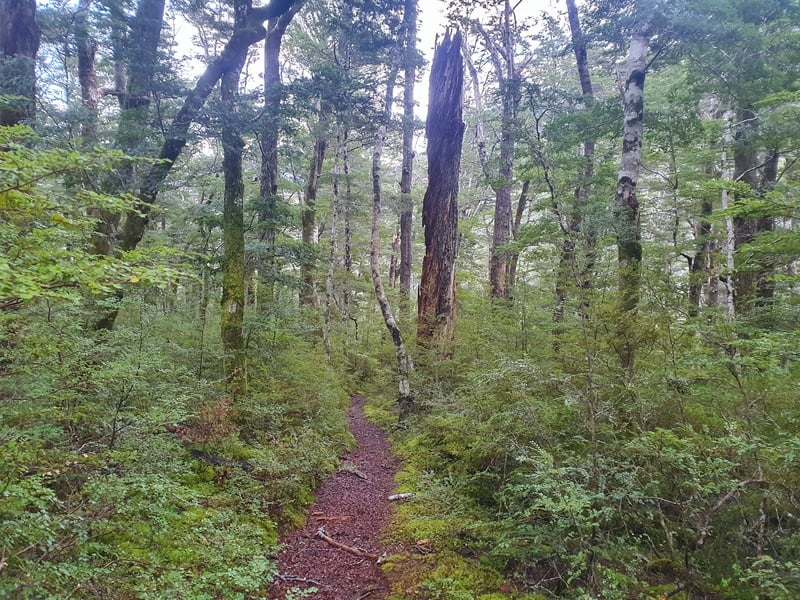
After an amazing hike up the Point 1345 on the topo map we wanted to squeeze in the Kiwi Burn Hut Loop Track before leaving the Mavora Lakes region back to Queenstown. We knew we’d only have about 2.5 hours of daylight, but had read there was an advanced and family-friendly routes to get to the hut.
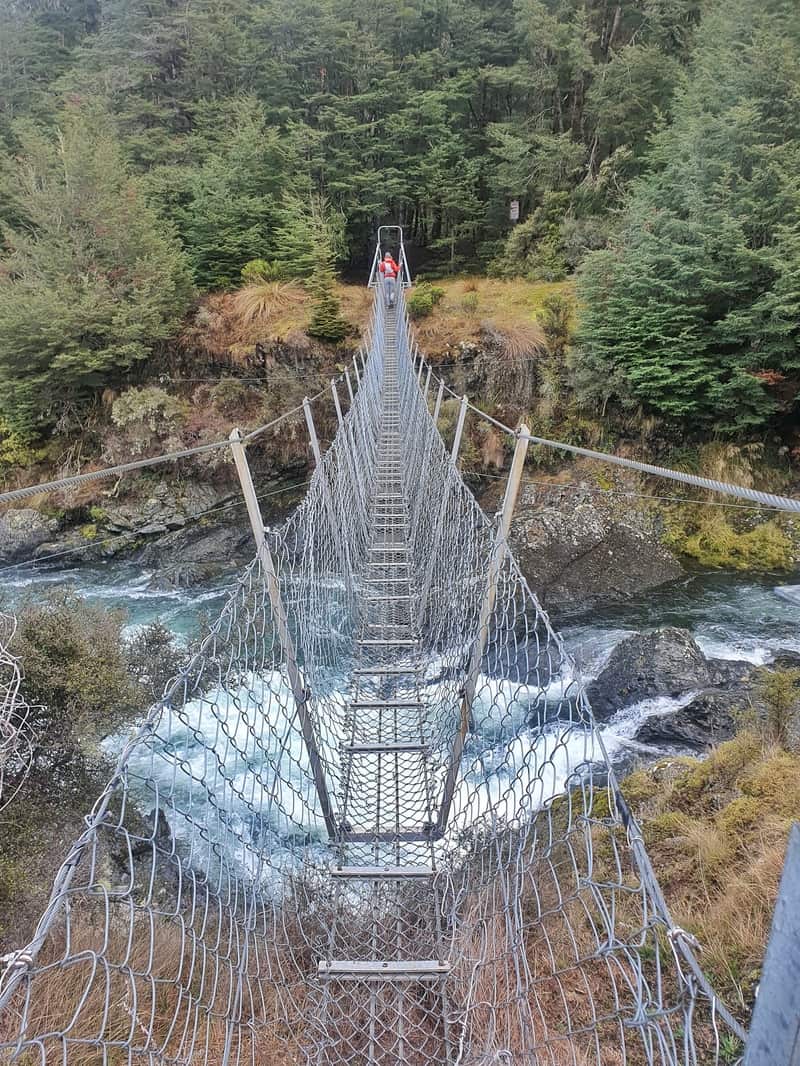
After crossing the swing bridge that crosses over the Mararoa River to start the track (an awesome way to start a hike) we veered right onto the advanced trail to get that part done while we still had daylight.
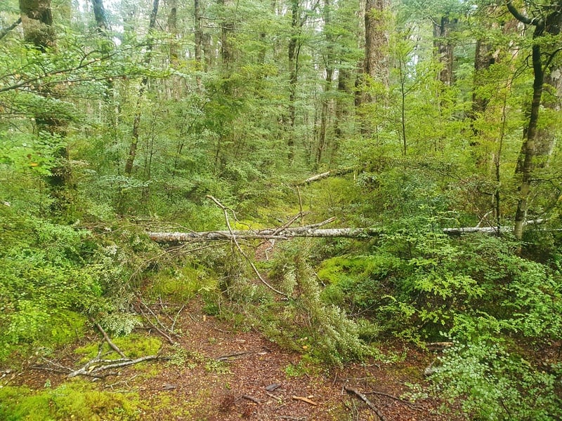
The track was in better condition than we thought to start with. There’s an obvious trail with plenty of orange triangles. There was treefall, but it was relatively minor and was always easy to get back onto the right track.
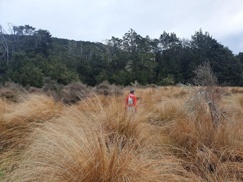
You’re in the bush for the first few kilometres, and while there’s some little short uphill sections, there’s nothing crazy about any of them. You’ll come into an opening for a few hundred metres eventually, this is a nice switch up with a few peaks in view.
Back into the bush again, and you’ll soon hit the high point of the route in the bush. Another decent takes you into a clearing where you’ll cross over the Kiwi Burn and see a green and yellow DOC sign. From here we go left to Kiwi Burn Hut. We’ve travelled about 3.6km at this point.
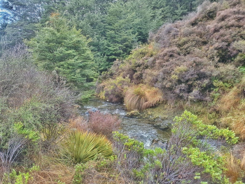
From here you’ll closely follow the Kiwi Burn Creek thingy which you’ll cross a few times. When we were hiking, there was quite a lot of muddy/swampy soft sections which is not outstanding to travel through.
Eventually the hut was in sight, and we got a little bit of hut fever here. We started straight lining it towards the hut…rather than looking at where the orange triangle markers were. Whoops!
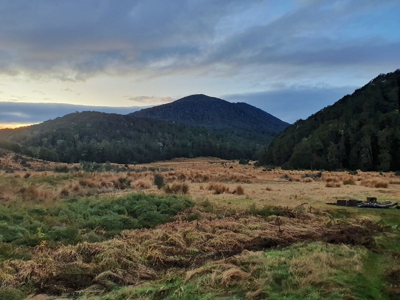
We eventually sloshed our way to the hut which is awesome! There’s a cool bonfire/firepit area out the front that’s been well used. And the hut is super cool. It’s definitely well visited over the summer months, but when we visited in late May, no one had been at the hut in 10 days (according to the intentions book).
Overall, the ‘advanced’ section of the track isn’t that advanced at all compare to many other tracks in the area like the Lake Marian Track.
Heading out onto the family friendly section of the track, it’s a cruise through the open field and crossing the Kiwi Burn one last time. Once we hit the forest, we realised the family friendly track isn’t that different to the advanced section…if anything, it’s the being shorter and not as hilly?
But we encountered a problem with major treefall, unlike I’ve ever seen. We put our speedy shoes on, but as soon as it got dark the track was so hard to follow while trying to navigate the massive amounts of treefall.
Our progress slowed as we struggled to find the track and orange triangles. We realised on the best topo map you can get to ensure we were progressing in the right direction.
Eventually we found our way back to the swing bridge but that was much much harder than the advanced section because of the tree fall. Of course, once we got back online we did see the following warning on the DOC website:

In short, don’t take hiking trails in NZ for granted. We definitely used route finding skills, and weren’t too worried about our predicament even in the dark…but can imagine some parties would be. In the daylight, things would have been much easier. But with the warning above, this isn’t a family friendly track at all. In time they’ll clear the treefall, and it’ll be a family friendly track again.
Wowee though, that was an unexpected turn!
The Kiwi Burn Hut Track is one that those in Queenstown which isn’t too far away rarely mention. Thee track is great, and a nice day hike.
Of course, you can always do it as an overnight trip too. The hut is popular from November through to April as it’s a nice hut for people walking the Te Araroa Trail.
So if you prefer the chance of having the hut to yourself, go between May and October. Or if you’re staying at the Mavora Lakes for a few nights, a night at the hut could be a nice change up.
If you’ve got any questions, comments, concerns about the Kiwi Hut Burn Track, drop a message below or email jub@churnewzealand.com.

Hey, it’s Jub here. I’m the guy behind Chur New Zealand, helping you have the best time hiking, trekking, walking…whatever you want to call it…in NZ. I’m based in Queenstown and am always out and about exploring trails, old & new. If you have any questions, reach out.

